

Sixteenth cyclone bulletin for Mauritius issued at 1310 hours on Thursday 27 February 2025.
Analysis from satellite and radar imageries over the past hours indicates that the intense tropical cyclone Garance is gradually weakening. It is a small core system with gusts exceeding 250 km/h very near to its centre.
At 1300 hours, Garance was centered at about 300 km to the north-west of Mauritius, in latitude 18.3 degrees south and longitude 55.3 degrees east. It is moving towards the southeast at 05 km/h.
The available numerical models are in agreement that Garance expected to recurve towards the south. Along this trajectory, it is dangerously approaching Mauritius and still constitutes a direct threat to the island.
A cyclone warning class III is in force in Mauritius.
The public is advised to maintain all precautions.
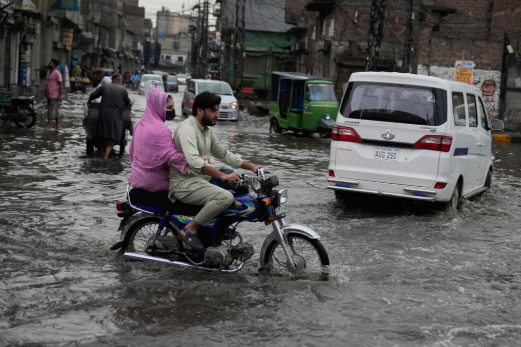
Active cloud bands associated with Garance will influence weather over Mauritius as from late this afternoon. The weather will be cloudy to overcast with showers, becoming moderate to heavy at times with thunderstorms, causing water accumulations and flooding in certain places.
During heavy showers, the public is advised to:
- remain in safe places and not to take shelter under trees in case of thunderstorms.
- avoid places prone to water accumulation, river banks and other water courses which may be flooded and certain mountain slopes prone to landslide.
- be very cautious on the roads due to reduced visibility resulting from heavy rains and fog patches.
Wind will blow from the north-east at a speed of about 30 km/h with gusts of the order of 80 km/h, strengthening gradually in the evening.
Sea rough to very rough with swells. Storm surge will cause coastal inundation along the northern and western coasts. The public is advised not to venture at sea and along beaches.
A cyclone warning class III is in force in Mauritius.
The next bulletin will be issued at around 1610 hours