

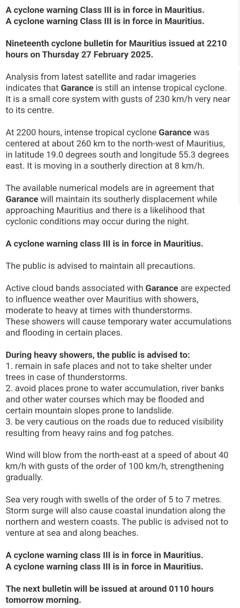
Analysis from latest satellite and radar imageries indicates that Garance is still an intense tropical cyclone. It is a small core system with gusts of 230 km/h very near to its centre.
At 2200 hours, intense tropical cyclone Garance was centered at about 260 km to the north-west of Mauritius, in latitude 19.0 degrees south and longitude 55.3 degrees east. It is moving in a southerly direction at 8 km/h.
The available numerical models are in agreement that Garance will maintain its southerly displacement while approaching Mauritius and there is a likelihood that cyclonic conditions may occur during the night.
A cyclone warning class III is in force in Mauritius.
The public is advised to maintain all precautions.
Active cloud bands associated with Garance are expected to influence weather over Mauritius with showers, moderate to heavy at times with thunderstorms.
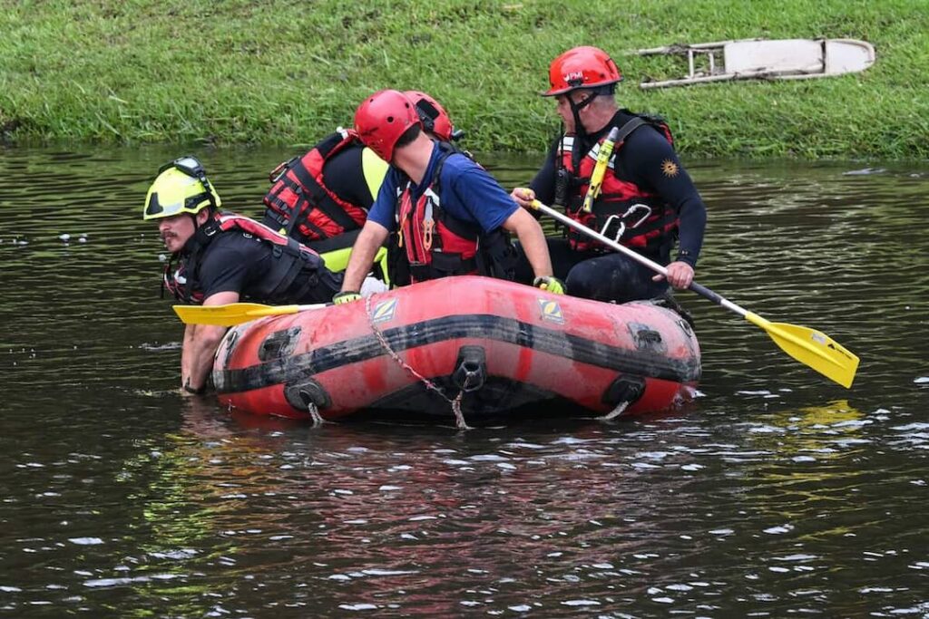
These showers will cause temporary water accumulations and flooding in certain places.
During heavy showers, the public is advised to:
- remain in safe places and not to take shelter under trees in case of thunderstorms.
- avoid places prone to water accumulation, river banks and other water courses which may be flooded and certain mountain slopes prone to landslide.
- be very cautious on the roads due to reduced visibility resulting from heavy rains and fog patches.
Wind will blow from the north-east at a speed of about 40 km/h with gusts of the order of 100 km/h, strengthening gradually.
Sea very rough with swells of the order of 5 to 7 metres. Storm surge will also cause coastal inundation along the northern and western coasts. The public is advised not to venture at sea and along beaches.
A cyclone warning class III is in force in Mauritius.
A cyclone warning class III is in force in Mauritius.
The next bulletin will be issued at around 0110 hours tomorrow morning.